For the experienced engineer, CAD drawing applications (such as AutoCAD) have been the main method of creating drawings on projects. In fact, CAD software has been around since the 1960s.
However, GIS applications have been in use successfully for over 30 years. In that time, it appears that engineers (particularly civil engineers) have been somewhat reluctant to adopt GIS systems, preferring instead to rely on CAD.
This seems to be down to a lack of awareness of the capabilities of GIS applications and how they can be used to generate not only drawings, but large amounts of useful data.
CAD applications will continue to have a role for the engineer, particularly with respect to intricate detailing of works. Indeed, GIS applications would not be suited to this task. But where large scale developments are being planned and designed, a GIS application comes into its own.
At its core, GIS consists of lines and points, with various attributes being assigned to each entity. But with practice, the engineer can construct a GIS file which is capable of generating drawings and data in various formats.
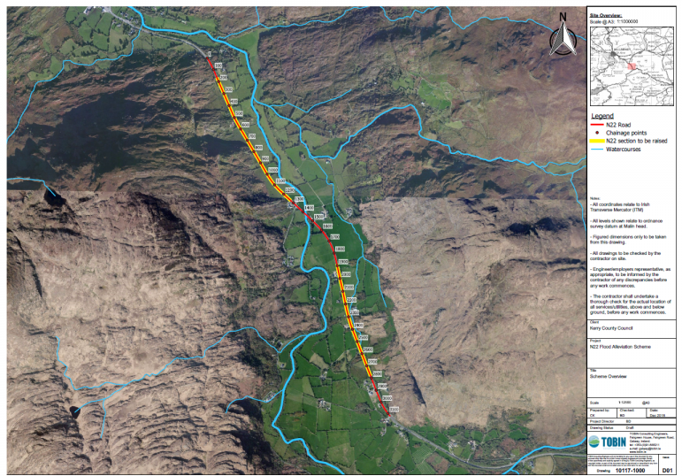
For instance, consider a watermain project of the order of tens of kilometres in length. For all layout drawings, GIS can be used effectively to digitise the layout of the proposed watermain. In addition to this, various attributes can be added to the watermain feature, such as diameter, material, location, etc.
GIS applications can automatically update the length of the watermain and number of fittings. These features can also be categorised in various ways, such as the number of fittings on watermains of a certain diameter, or the length of watermain within a certain county. The output of this information can be shown as a colour coded drawing showing the various categories.

While the above example is only scratching the surface of GIS capabilities, it demonstrates the potential for GIS to be used more extensively on future projects. And rather than seeing CAD and GIS as competing philosophies, we need to realise that each has its place. And that place could be side-by-side on a project.


